I had tried a handful of iterations of a North / West Vancouver version of the Burnabop XL in an effort to create an “XL Bop Series”. My thought was to have a North Vancouver, Burnaby, and Port Moody/Coquitlam trio. Three’s a nice number. Manageable to host an ‘event day’ for each in a year. It’s settled into what you see here, comprised of east and west loops with a traverse either side of the Upper Levels highway between them. The traverse itself is great too – it might look like a utilitarian part of the route, but there’s cheeky trails and fun to be had in both directions as you navigate between the loops.
.
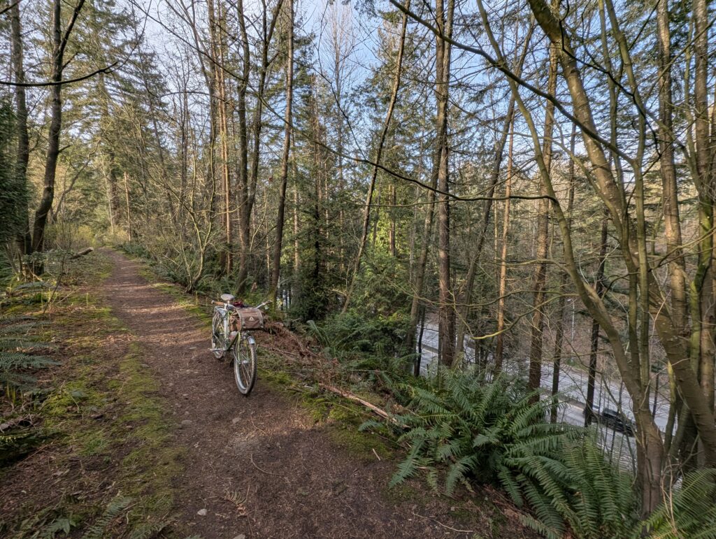
The route starts and ends at Bridgeman Park, where washrooms, water, and covered areas are available. The route then heads east, dipping into Northlands Park, the site of a former military training center as noted by the signage. Don’t stress about the warnings; just maybe stick to the trail though. After a couple creek crossings you’ll traverse over to the Hyannis trail area and down to familiar Fisherman’s, up to the LSCR parkway. The traverse through Lynn Valley is perhaps confusing the first time, but a really lovely way to get across the area via neighbourhood trails and quiet streets. A small detour north on the powerlines would take you to see some very lovely horses, if you wanted an excuse to stop here.
.
The westbound traverse parallels the highway to the north, starting with a really fun fence line section then a lovely descent all the way to Westview. After crossing the bridge you’ll pop up a trail to get into Edgemont, where coffee and snacks are readily available, before descending into Murdo Frazer Park. You can ride down to the right of the stairs but it’s a bit steep and loose. If you’ve never been to Murdo Frazer before, make sure you have a few spare minutes to explore the cabins and pond! Look for turtles on the fallen tree in the pond.
.
From here the climb to the dam is pretty painless, but the subsequent climb up the British Properties, well, you know. I wish I could send you into the woods instead, but alas, not quite yet. Millstream trail is next though, and it’s a favourite of mine. The trail starts out wide and smooth, lulling you into a false sense of security, before gradually becoming rougher and narrower until you’re staring into a ravine crossing. What’s more, the second ravine is significantly deeper than the first. But then, almost magically, you’re at the Cypress lookout surrounded by tourists.
.
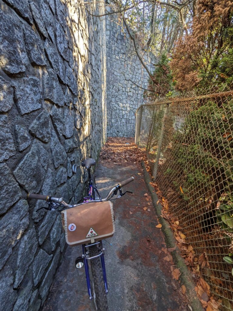
The next section is really fun too – a fairly hidden descent under the lookout that traces along the side of Marr Creek until you’re spat out onto Chippendale Rd. A short road descent, followed by a mountain path descent, followed by a steep connector trail and you’re at the foot of Cypress Bowl Rd. Once you cross the highway overpass, a cheeky and wonderful fence line trail awaits you – careful not to miss it! The traverse continues to stay high, and this series of quiet roads and connecting trails is a great way to go up to Cypress in the other direction, too.
.
Once across Capilano River, a short push up to the Upper Levels is the the last real climb of the route and worth it for the gravel descent along the Loutet area, down to the finish.
.